13 Best Trails For Hiking In Kuching [2023 Update]
Are you a passionate hiker and looking for the next challenge? Hiking in Kuching will provide you with exactly just that.
Besides that, hiking in Kuching is one of the best places for adventure seekers simply because of the beautiful landscape surrounding the city. Kuching is located in the biggest state in Malaysia called Sarawak which is located in Borneo.
Borneo is known to be one of the oldest rainforests in the world, so you will be able to check out some exquisite flora and fauna if you choose to go.
The world’s largest flower, Rafflesia, is situated in Kuching. You will be able to see this one-of-a-kind flower when you go hiking in Kuching.
This is a list of the top 13 trails we are going to check out in this article :
1)Bako National Park
2)Kubah National Park
3)Taman Negara Santubong
4)Tanjung Datu National Park
5)Baki Trail Point
6)Mountain Singai
7)Matang Wildlife Centre
8)Gunung Gading National Park
9)Fairy Caves
10)Kampung Sting, Bengoh
11)Padawan
12)Brooke Heritage Trail, Bung Muan
13)Bukit Batu Selabat
What are we waiting for? Let us go hiking in Kuching, friends!
Related Post:
- 14 Best Islands In Sabah
- 21 Hiking In Selangor Trails You Probably Don’t Know About 2022!
- Hiking Penang Hill: Your Complete Guide
- 9 Hikes in KL, Malaysia You May Not Know About
- 41 Malaysia Short Getaways To Explore In 2022!
- 7 Beaches In Kelantan You Cannot Miss In 2022!
- Apple Watch Hiking Apps: The Ultimate Guide (2022)
- Mabul Island Diving – An Insider’s Guide for 2022!
- 405+ Instagram Captions For Hiking To Inspire Wanderlust!
DISCLOSURE
Some of the links on here are affiliate links and I may earn if you click on them, AT NO EXTRA cost to you. Hope you find the information here useful! Thanks.
1) Bako National Park

This breathtaking national park is known as Sarawak’s oldest national park and one of the MUST places to go hiking in Sarawak.
If you want to have multiple wildlife encounters, this is your place to go!
It is also home to the endangered Proboscis monkey.
It is quite hard not to spot this one-of-a-kind mammal because of its distinct long nose and pot bellies.
You can either do a day trip to this Kuching hiking place or you can choose to stay the
night at the National Park as there is accommodation on-site.
Basic lodgings are
provided and you may do your booking on their official site.
How to Get to Bako National Park:
To reach this hiking place in Kuching, you will have to drive roughly 37KM from Kuching town to Kampung Bako.
If you are using Grab, it will cost you about RM30($7), one way. A taxi will cost you about RM60-RM70($14-$16), one way.
Once you reach Kampung Bako, at the Bako Jetty, you will have to pay the park entry fees and book a boat to reach Bako National Park which will be explained further below.
The boat ride to the park HQ will take you about 20-30 minutes. I promise you that you will not realize time passing because the views are breathtaking.

Fees to enter Bako National Park:
These are the entrance fees for both foreigners and Malaysians. Please bring your identity documents (i.e: MyKad or passport)
| Adult | Children(7-18years) | |
| Malaysian | RM10($3) | RM3($1) |
| Foreigners | RM20($5) | RM7($2) |
For children 6 years and below, it is free to enter this hiking place in Kuching.
Variety of trails at Bako National Park:
There are 18 trails in this National Park and they are all color-coded and they vary from short and easy walks to full-day hikes.
There are a number of them that are closed due to maintenance.
The most famous trekking trails that you may encounter in this Kuching hiking place are Lintang Loop, Telok Pandan Kecil, and Telok Paku.
If you take the Telok Pandan Kecil trail, it will lead you to a small beach.
It is beautiful and people would normally take a dip after the hike. Recently, there have been sightings of crocodiles at the beaches so visitors are advised to not swim in the sea.
You will pass through most of the habitat types in this park if you choose to hike Lintang Loop.
If you are a beginner in hiking, I would advise hiking Teluk Paku which is quite an easy trail since it is near the HQ park and it passes through cliff vegetation and beach.
If you are into wildlife watching, I would advise hiking the trails near the HQ park( Teluk Delima, Telok Sapi, and Telok Paku).
After hiking any one of these trails, you can have lunch at the cafes around the HQ after which you can spot wildlife such as the one-of-a-kind bearded pig.

Out of the total of 18 hiking trails in this National Park, only 9 are functional and these are the names of the trails:
a)Tanjung Sapi
b)Tanjung Rhu
c)Tajor
d)Lintang Loop
e)Telok Pandan Kecil
f)Telok Pandan Besar
g)Telok Delima
h)Ulu Assam
i)Telok Paku
Hike Time and Difficulty Level At Bako National Park:
The trail distance varies from 0.25KM to 5.25KM one way from HQ.
Depending on your stamina, the hike may take you anywhere between 30 minutes to 90 minutes one way from HQ.
Please wear proper sports shoes or as the locals call it ‘Adidas Kampung’. It is their version of Adidas. It is only RM15($4) and can be bought at any local stores nearby(e.g DIY)
2)Kubah National Park
If Bako National Park is a place to spot wildlife, Kubah National Park is a place to spot exquisite birds, and recently frogs too. (If you are into those sorts of things, HEHE)
This hiking place in Kuching is about 2,230 hectares in size.
It is made up of a dipterocarp forest which has a mix of palm trees, orchids, and pitcher plants.
It is a perfect place for a day hiking trip. If you are like me and love waking up in the jungle, you can opt to stay the night at this national park too. Accommodations can be found here.
Please bear in mind that the accommodation here is basic.
There are no food stalls in the park so do bring your own food and clean after yourself. If you are staying, the accommodations provide basic BBQ facilities.
How To Get To Kubah National Park:
This Kuching hiking place is not too far away from the heart of Kuching. It is a 45 minutes drive. You can opt to travel to this National Park via a variety of ways:
a) Bus: City Link Bus departs every 2-3 hours. The first bus departs from Kuching at
8 am from the bus station near Saujana car park. The last bus moves out from
Kubah National Park at 3 pm. Its fare is RM4($1) one way.
b) GrabCar: This is a little more pricey but it is always available. Its fare is RM25($6),
one way.
Fees To Enter Kubah National Park
The entrance fee varies between foreigners and Malaysians. Please bring your identification details(e.g: passport or MyKad)
| Adult | Children(7-18years) | |
| Malaysian | RM10($3) | RM3($1) |
| Foreigners | RM20($5) | RM7($2) |
For children 6 years and below, it is free to enter this hiking place in Kuching.
Variety Of Trails At Kubah National Park:
There are 7 trails present in Kubah National Park and they are all color-coded. These are their names:
- Palmetum – Interested in checking out palm plantations? This is the trail for you.
It is also the shortest trail. - Belian Trail – Belian in English is Ironwood and this trail is full of these gigantic trees.
- Selang Trail – This trail ends at a viewing point.
- Main Trail
- Waterfall Trail – Most famous one as it leads to rock pools and waterfalls.
- Rayu Trail – This trail connects Kubah to Matang Wildlife Center.
- Summit Trail – This is the longest trail and it will lead you to the top of Mount Serapi.
Hike Time And Difficulty Level At Kubah National Park:
Anywhere between 30 minutes to 4 hours, one way. Depending on the trail you choose. The trails range from moderate to difficult.
3)Santubong National Park
Santubong National Park is made up of the 810m peak of Mount Santubong surrounded by rainforests.
If you like a little mystery during your hike, this would be the place for you!
There are a variety of stories in regards to the famous Mount Santubong.
I will share one of them here and you may ask the locals around there when you go for a hike. Apparently, in those days, there were interactions between the celestial kingdoms and earth.
Two princesses, Puteri Santubong and Puteri Sejinjang were sent down from that kingdom to earth to help with a war between two villages. They were both pretty and talented. One was famous for weaving and another was talented in pounding rice.
While they were on earth, they both fell in love with a prince.
Out of jealousy, both the princess ended up hitting each other. Puteri Santubong became the Mount Santubong that you can hike to and if you see it from the sea, you can see the dent on her head due to the hit received from Puteri Sejinjang’s rice pounder.
Puteri Sejinjang was hit on the head and her head broke into many pieces which formed the small islands nearby.
How To Get To Santubong National Park:
This hiking place in Kuching is about 35KM from Kuching town.
You can hire a GRAB from town to this National Park and it will cost you about RM65($15) one way.
Fees To Enter To Santubong National Park:
There is no need to pay entrance fees but visitors will need to register at the Santubong National Park entry station.
Variety Of Trails At Santubong National Park:
There are only 2 trails available when you choose to go to this Kuching hiking place:
1) To the summit: The trails are marked by red marks and they have made it very
obvious all along the way. The red marks will either be on boards or
the huge rocks so there is no way you would miss it.
2) To the popular waterfall and swimming hole: This trail is marked with blue marks. It’s a short hike and it rounds up near the entry station.
Hike Time And Difficulty Level At Santubong National Park:
The park is open only from 8.00 AM to 5.00 PM. If you choose to hike to the summit, please make sure you start your descent latest by 3.00 pm.
The difficulty level depends on your stamina level. It is said to be from moderate to difficult.
4)Tanjung Datu National Park
This hiking place in Kuching used to be Sarawak’s best-kept secret because of its hiddenness.
This National Park consists of a mixture of rainforests, beaches, and wildlife.
It is the only beach in Sarawak where you can catch green turtles and even dolphins swimming.
It is easily one of Sarawak’s smallest National Parks covering an area of 14 square kilometers.
Because it was hidden from humans, the beach at this National Park has beautiful corals growing in it and may just be the next spot for divers!
How To Get To Tanjung Datu National Park:
Previously, you would have to drive 2 hours from Kuching to Sematan, then take a boat to Tanjung Datu National Park.
In 2019, roads were built directly to a place called the Telok Melano village which serves as a jumping-off point from the park.
So it’s a 2 ½ drive from Kuching to Telok Melano, after which one can either trek to the park or take a boat.
Variety Of Trails At Tanjung Datu National Park:
There are a total of 4 trails in this National Park.
a)Viewpoint Trail – It is a super short trail but steep. At an 80m high cliff-top, you will be
able to see the entire park and even see dolphins swimming on a
clear day!
b) Belian Trail – This is a challenging hike, but you will reach a viewpoint that is 542m
above sea level at the peak of Mount Melano.
c) Pasir Antu Laut Trail – The trail is about 2.7km. This hike will bring on a loop from the
HQ to the beautiful clear beach.
d) Telok Melano Trail – This trail is the longest. It originates from the Telok Melano
Village, which is a fisherman’s village. It emerges at Teluk Upas,
which is a beautiful sandy beach where you can also do some
snorkeling.
Due to the distance from Kuching town, it is normally advisable to stay the night and enjoy the beauty. You can check out tour packages here.
Hike Time And Difficulty Level At Tanjung Datu National Park:
The hike time is around 20 – 90 minutes, depending on which trail. The trail difficulty level ranges from moderate to difficult.
5)Baki Trail Point
This hiking place in Kuching is relatively near the town itself. It is only about 25 minutes away.
How To Get To Baki Trail Point:
This Kuching hiking place is a perfect spot if you are looking for a place to hike in the town itself. It is situated about 14km from the town. This may cost you about RM30($7), one way via GRAB.
Hike Time And Difficulty Level At Baki Trail Point:
It will take you a maximum of 30 minutes to complete this hike and it is relatively easy.
6)Mountain Singai
Known for its pilgrimage purposes, this hiking place in Kuching is a famous place
People normally hike this mountain for the catholic church situated above it. Recently many adventure seekers have been hiking to the summit too.
How To Get To Mountain Singai:
It is located in Bau, which is about 40 minutes from Kuching town.
It takes you about an hour to hike to the church.
The pathway to the church is well done with a wooden staircase and an ample amount of resting place. The actual challenge comes after the church when you start hiking to the summit.
Fees To Enter To Mountain Singai:
There is no fee needed to hike this please but because the church is undergoing renovation, there are plastics filled with construction materials that visitors are encouraged to carry and drop off at the church.
So, please help the locals out, they will appreciate it!
Hike Time And Difficulty Level At Mountain Singai:
It will take you about a total of 2-3 hours to reach the summit. The hike up is challenging with ropes provided to hike some steep areas. The difficulty level is from moderated to hard.
7) Matang Wildlife Center
This Kuching hiking place is a dedicated center to rehabilitate endangered species such as the Orangutan and Rhinoceros Hornbill.
It is part of Kubah National Park. Bear in mind, that this is not a zoo. They pick up orphaned animals and provide space for these animals to grow in safe surroundings.
How To Get To Matang Wildlife Center:
It is about 34km from Kuching town and it will be a 45-minute drive.
Fees To Enter To Matang Wildlife Center:
| Adult | Children(7-18years) | |
| Malaysian | RM10($3) | RM3($1) |
| Foreigners | RM20($5) | RM7($2) |
Please bring your identification details for entry.
For children 6 years and below, entrance is free.
Variety Of Trails At Matang Wildlife Center:
- Pitcher Trail (takes about 2 hours),
- Sungai Rayu Trail (about 3 – 4 hours)
- Sungai Senduk trail (about 1 hour)
- Sungai Buluh trail (about 2 hours)
Hike Time And Difficulty Level At Matang Wildlife Center:
The hike time will be anywhere between an hour to 4 hours, depending on which trail you choose. The difficulty level is from moderate to difficult.
8)Gunung Gading National Park
Would you like to check out the famous Rafflesia flower a.k.a the largest flower in the world, which is Sarawak’s pride and joy? This is where you MUST go when you go hiking in Sarawak.
I had the privilege of seeing this flower in all of its pride and also a baby version of it!

You can choose to either make a day trip here or stay the night.
How To Get To Gunung Gading National Park:
Gunung Gading National Park is situated in a town called Lundu which is around 75km from Kuching town.
You can either rent a car from Kuching town and drive yourself to Gunung Gading or catch a bus from Kuching Sentral Bus Terminal to Lundu.
Then get on a Pandan Beach Bus or local travel vans that are always available, to the entrance of this National Park.
There is no food at the park, so you will have to fuel yourself at Lundu town before hiking.
Fees To Enter To Gunung Gading National Park:
| Adult | Children(7-18years) | |
| Malaysian | RM10($3) | RM3($1) |
| Foreigners | RM20($5) | RM7($2) |
Please bring your identification details.
For children below the age of 6, entry is free.
Variety Of Trails At Gunung Gading National Park
At the entrance of the national park, you will see a board of trails for you to hike.
There are 2 trails. One is specifically only to see the Rafflesia flower while the other challenging one is to summit Gunung Gading mountain.
The trail leading to the summit will pass several breathtaking waterfalls.
Hike Time And Difficulty Level At Gunung Gading National Park
Around 3-4 hours to the summit. The Rafflesia trail will take you about 1 hour, max.
The Rafflesia trail is relatively easy. The trail to the summit can be from moderate to difficult.
9)Fairy Caves
This is a limestone cave. It is famous for rock climbing and has a beautiful view at the end of the trail.
How To Get To Fairy Cave:
It is located in a town called Bau, located about 40km from Kuching town. That is a 30-minute drive.
Fees To Enter To Fairy Cave:
It used to be free but recently they have started charging people RM1($0.25) which I think is reasonable to help them with the cost of maintaining the area.
Your visiting hours are only from 9.00 am-4.00 p.m. They are closed every Monday.
Hike Time And Difficulty Level At Fairy Cave
It will take you about an hour or two to explore this place. Depending on your stamina, the trail can be easy to moderate for you.
10) Kampung Sting, Bengoh
This is a beautiful hidden gem that you can explore if you choose to go hiking in Sarawak.
This place is famous for its curtain waterfalls. You will have to take a 45-minute drive from Kuching town to Bengoh Dam.
How To Get To Kampung Sting, Bengoh:
About 50km away from Kuching town. This will take you about an hour or so drive. Once you reach Bengoh Dam, you will have to register at the entrance. There are no fees needed to enter but you will need a boat which you will need to book prior. You can either choose to make a day trip or stay the night as they are beautiful but simple homestays above.
Hike Time And Difficulty Level At Kampung Sting, Bengoh:
Once you reach the banks of Bengoh Dam, you will need to hike about 20 minutes to the Kampung Sting nearby. Depending on your stamina, the overall hike can be from moderate to difficult.
Once you are there, you can hike to the beautiful waterfalls above it. Your tour guides will be the locals in the village where you can choose to stay.
11)Padawan
Also famous for its beautiful waterfall, this hiking place in Kuching is located an hour away from town.
There are 2 villages here that are famous for their waterfall and a perfect place for hiking:
a)Kampung Sadir

b)Kampung Sapit.
To avoid disappointment, you can book your trekking packages earlier.
Besides checking out beautiful waterfalls, you will be able to indulge in some Bidayuh Culture, one of the local traditional cultures in Sarawak.
How To Get To Padawan:
- Kampung Sadir
- This is a one-hour drive from Kuching. Once you reach the village, there will be locals around whom you can ask to help you guide up to the waterfalls.
- Kampung Sapit.
- This is situated 60km from Kuching town.
Hike Time And Difficulty Level At Padawan:
- The waterfall that is in Kampung Sadir, called Ban Buan Kukuot Waterfall is about a 2-hour hike whereas Mabi Waterfall is only a 30-minute hike.
- At Kampung Sapit, there are 3 trails that will lead you to Subah, Sangoh, and Gangdang Waterfall.
- The hike is easy to moderate
12)Brooke Heritage Trail, Bung Muan
This Kuching hiking place is situated in Kampung Peninjau Lama, Siniawan. It is an easily accessible place but not so famous and that’s what makes it even more beautiful.
It has a touch of history as it is known as Rajah Brooke’s Heritage Site(go read up on your history!)
How To Get To Brooke Heritage Trail, Bung Muan:
It is about 25km away from Kuching town.
You can reach here via GRAB which may cost you around RM20($5), one way.
Once you reach the village, you will have to pay a certain fee. At the foothill of the village, the local villagers will greet you and brief you before you start the hike.
Fees To Enter Brooke Heritage Trail, Bung Muan:
RM5($1)
Hike Time And Difficulty Level At Brooke Heritage Trail, Bung Muan:
About 3 hours, one way. With breaks in between, that is.
This hike is relatively hard.
13) Bukit Batu Selabat
When you choose to go hiking in Sarawak and would love an easy day trip hike, this is definitely the place to go! You can choose to come here if you would like to catch sunsets or even sunrise.
Whilst you are there, don’t forget to check out the waterfall called Arong Serait.
How To Get To Bukit Batu Selabat:
It is located 25km from Kuching town in a place called Muara Tebas.
It is advised to get a guide to help through the hike even if it may be easy. Encik Fairuz is the local guide and you may reach him by clicking on this number, +60178967961. It will redirect you to WhatsApp directly.
Fees To Enter To Bukit Batu Selabat
The entrance fee is RM10($2.5) per person, and RM50($12) for your guide.
Hike Time And Difficulty Level At Bukit Batu Selabat:
Anywhere between 60-90 minutes one way.
The hike is easy to moderate.
Are There Waterfalls In Kuching
The Santubong Waterfall is the first on the list. Below are the rest:
- Kubah Waterfall and Mount Serapi waterfall at Kubah National Park.
- Waterfall number 1 and number 7. These are the names of the waterfall at Gunung Gading National Park. Waterfall number 7 is the highest and the most dangerous one to hike to.
- Just a little above Gunung Gading, there is a breathtaking waterfall called Jangkar Waterfall.

Is It Safe To Travel To Kuching?
YES, it is safe to travel to Kuching.With relatively low crime rates, Sarawak in general is a safe destination. Tourists, in general, should follow precautions such as do not walk in dark alleys, do not walk alone at night, keep their belongings in safe places, and always using registered taxis.
When Is The Best Time To Visit Kuching?
Wondering when is the best time to visit Kuching? The answer is during the hottest and driest months of April to October. Not only that, you do not want to miss the annual Rainforest Music Festival that is held every year in July and the famous Gawai Dayak festival on June 1.
Hiking In Sarawak, What Are The Essential Tips For Hiking?
These are some essential tips for hiking in Sarawak:
a)Make sure at least one other person knows your hiking plans
b)Always bring enough water
c)Fill your bag will only the necessities such as to enjoy the hike without extra weight.
d)Always hike with a companion, especially if this is your first time hiking in Kuching.
These are some tips based on personal experience hiking in Kuching:
a)Sarawakians are very spiritual people. Even back in the day, their ancestors pray to trees and
the jungle in general.
b)So when you choose to go to any Kuching hiking place, regardless of whether you believe in
God or not, just say a little prayer before entering the jungle.
c)Don’t say anything degrading, don’t pee around, and keep the place clean.
How Do I Find Local Hiking Groups?
Using the internet, you can find hiking buddies and hiking group opportunities.
Below are a few groups of people who are adventure-seekers like you:
Based on personal experience, Sarawakians are one of the friendliest groups of people. You will feel like family within an hour of being in their presence.
So, even if you decide to go solo traveling to Kuching and decide to go hiking in Sarawak, you are in safe hands.
What Are Accessories For Hiking?
On your checklist, these are among the things that should be on them:
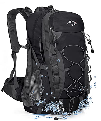

1)A backpack that can fit all the necessities. You will need weather-appropriate clothing.


2)Ladies, please do wear long pants as there are insects everywhere and some places may


even have leeches. Men, I have you covered too.


4) Kampung Adidas, only found in Sarawak.


Related Posts
- Best Hiking Shirts For Hot Weather [ For Women And Men]
- Best Lightweight Long Sleeve Hiking Shirt Womens
- 5 Plus Size Hiking Activewear [For Women and Men] 2022
- 11 Best Hiking Boots for Under 100 dollars In 2022 (Comfy!)
- Do You Wear Socks With Hiking Sandals? Answered + Best Hiking Socks ! [2022]
- Can You Wear Hiking Boots With Shorts – An Ultimate Guide 2022
Please bring lots of water, it is not advised to drink from the river unless the locals around tell you it’s safe to.
Are There Extinct Plants and Animals In Sarawak?
Yes, there are extinct plants and animals in Sarawak. According to the WorldWide Fund for Nature(WWF), there are 279 species of plants and 45 species of animals that are listed as critically endangered.
When you choose to go hiking in Sarawak, these are the few one of a kind flora and fauna you need to keep an eye out for because they can only be found in these jungles:
- The Proboscis Monkey
- Rafflesia Flower
- Bearded Pig
- Rhinoceros Hornbill
The jungles of Sarawak are filled with dipterocarp trees. They are home to many species of animals and they are super huge.

Doesn’t this make you feel like the huge tree is giving you an invitation to hug it?
I am an avid tree hugger simply because huge trees like this make me feel at home.
When you choose to go hiking in Sarawak, the forests are filled with these breathtaking gigantic trees!
![7 One Day Tour Penang [Highest Rated!]](https://womenwanderingbeyond.com/wp-content/uploads/2023/02/One-Day-Tour-Penang-3.jpg)

![Can You Wear Running Shoes For Hiking? [Personal Experience!]](https://womenwanderingbeyond.com/wp-content/uploads/2022/10/Can-You-Wear-Running-Shoes-For-Hiking-2-768x576.jpg)
![Can You Wear Hiking Boots In The Snow [2023 Update]](https://womenwanderingbeyond.com/wp-content/uploads/2022/08/Can-You-Wear-Hiking-Boots-In-The-Snow-1-768x550.jpg)
![30+ Best Nyonya Food in Melaka [Personally Tested!]](https://womenwanderingbeyond.com/wp-content/uploads/2021/03/best-nyonya-food-in-Melaka-5-768x749.jpg)
